Navionics Charts Now Available in SailTimer App
No pixellation + fast display of tacking results
We are pleased to announce that worldwide marine charts from Navionics are now available in the free SailTimer™ navigation app on iOS. Unlike raster chart images, these vector charts have no seams, quick download, small file sizes, and fast display. The Easy View button gives the option to make numbers and text extra-large. Zoom in as much as you want, with no pixellation.

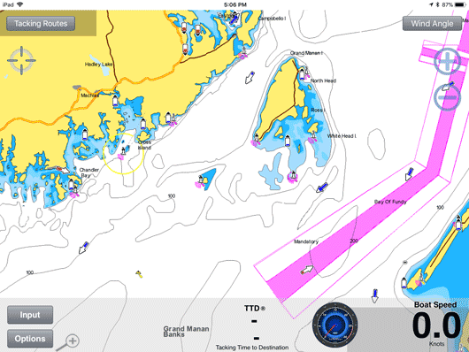
Out of all of the GPS chartplotters and apps available, only SailTimer uses actual tacking distances to determine your optimal tacking route. It is obviously easy to measure distance in the GPS era, but traditional measures like ETA and VMG do not do this (as shown here). But if they don't know how far you are going to travel, how can they calculate your ETA or tacking results correctly? The SailTimer tacking results solve this problem. For both racers and cruisers, the SailTimer app can learn your boat's polar plots, and use these with tacking distances to display your optimal tacks.
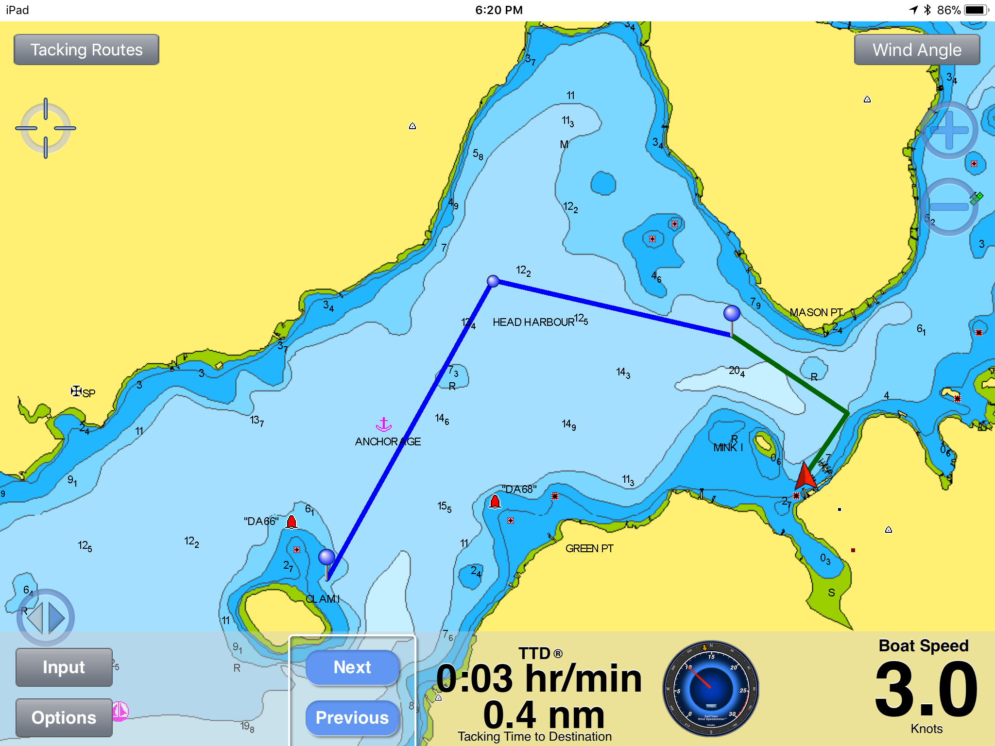
The screenshot above shows the patented SailTimer™ tacking results being displayed on the new Navionics vector charts. The blue line is the route from waypoint to waypoint. The red triangle is the boat location. The green lines show the optimal tacks to the waypoint. There are also Next and Previous buttons, for when you want to see the optimal tacks to the next waypoint. The overall Tacking Time to Destination (TTD ®) is always available centered on the bottom bar. GPS tracks can also be displayed with your tacking results, and emailed to share your trip with others.
Don't let the low price fool you: this is the most advanced sailboat navigation system available in any product. Yet it is quick and easy to use. When you are busy out on the water, there is just one number for your TTD and one line for your optimal tacks. Simple yet powerful.
All sailors need wind information to navigate. Wind speed and direction can be entered manually in the SailTimer app to display the optimal tacks. But if using the wireless SailTimer Wind Instrument™ with the SailTimer app, you can see a graph of boat speed with Apparent and True wind speed, and as wind conditions change the app updates your tacks automatically.
HOW TO USE YOUR NAVIONICS ACCOUNT IN THE SAILTIMER APP
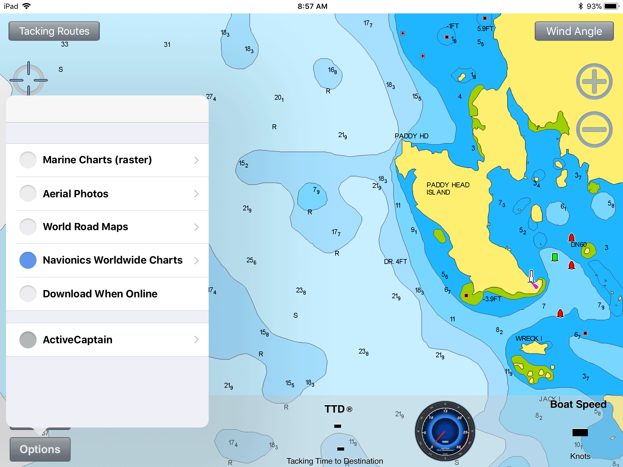
Display your tacking results on beautiful vector charts: If you have (or get) a Navionics Boating app and chart subscription, you can log in to your Navionics account in the SailTimer app.

You can get the subscription as an in-app purchase from the free Navionics Boating app or a paid Navionics app with charts included. Create an account in a Navionics app (not at Navionics.com), then use the same login in the SailTimer app under Options > Charts. With an annual subscription of US$10.50 / €10.50 / AU$14.99, these vector charts have better features and a lower price than raster charts.
CHECKING TIDE LEVELS AND CURRENT IN THE SAILTIMER APP
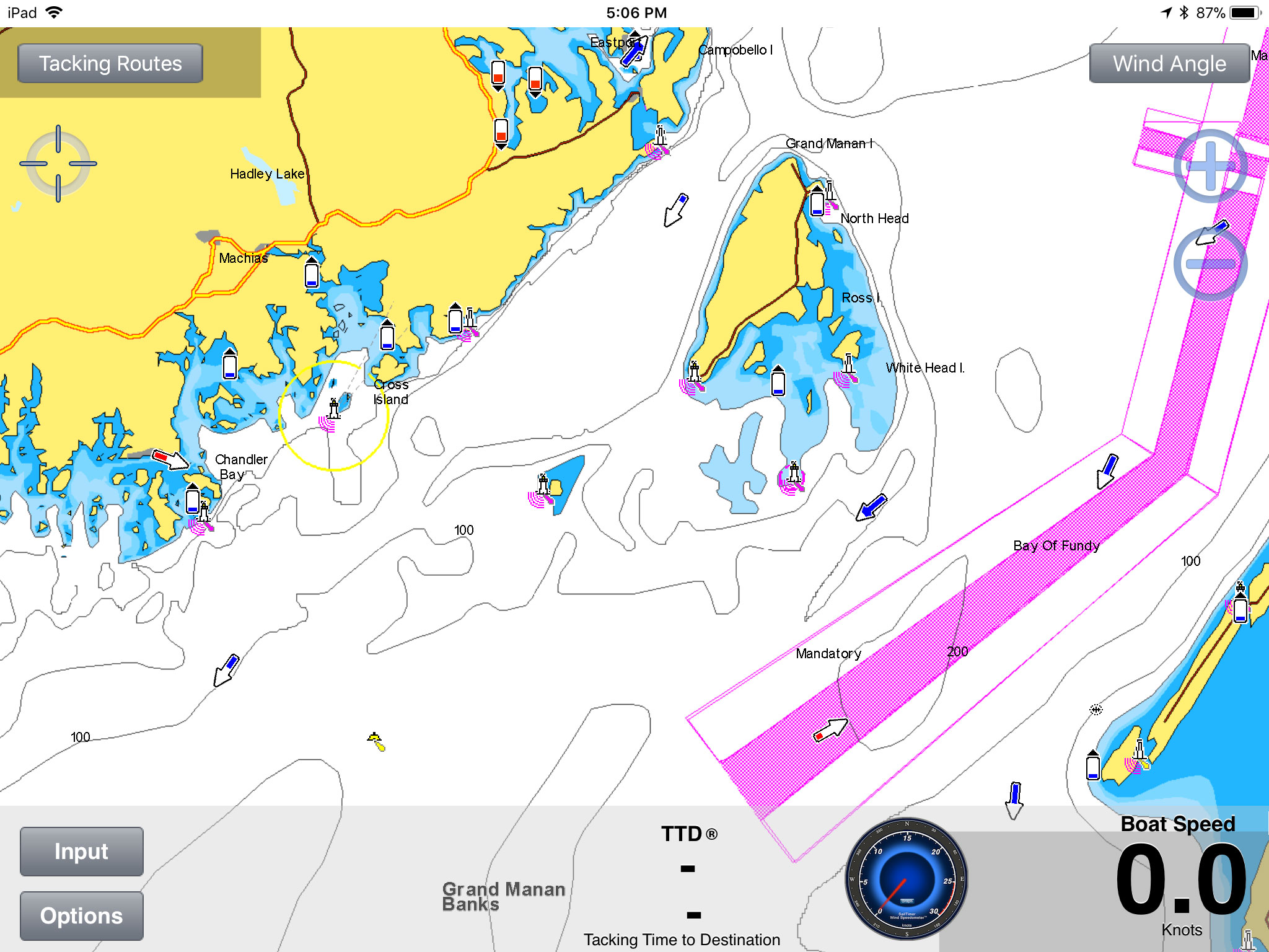
In the screenshot below, you can see both Tide and Current icons (click to enlarge). The icons for both can have different levels and colors. Red icons warn that Tide is falling / Current is speeding up. Blue icons indicate that Tide is rising / Current is slowing.
By zooming in you can also see large tide icons and large current icons with their value. The Tide value is an offset from Mean Low Water (MLW) or Lowest Astronomical Tide (LAT) (depending on region). If you see 0-subscript-2 for the Tide in a red icon with a downward triangle, it means the Tide is going down and is at the reference level + 0.2 in the selected depth unit. For the Current arrow, if you see 3-subscript-7 in a red arrow, that means that the Current has a speed of 3.7 knots and is accelerating.
AUSTRALIAN MARINE CHARTS IN THE SAILTIMER APP
Over the years we have had a lot of requests from sailors in Australia who wanted to see their optimal tacks on Australian charts. Good news just in time for springtime in Australia: if you use the SailTimer app or Wind Instrument, you can finally overlay your optimal tacks on official vector marine charts. :-)